
MapX pilot project
Plan Bleu, through its role as an Observatory for the environment and development in the Mediterranean, has the mission to provide public and private decision-makers with data, indicators, analyzes and knowledge to feed thoughts on environmental issues and interactions between environment and development.
The MSSD and its dashboard are the MAP’s strategic and technical tool (led by Plan Bleu) to monitor sustainability at regional level by providing a set of 28 indicators. To achieve these objectives of monitoring sustainability and supporting decision-making processes, Plan Bleu is working to set up a Mediterranean observatory in a network, involving specialized national agencies such as statistical institutes, thematic observatories, laboratories and ministerial departments.
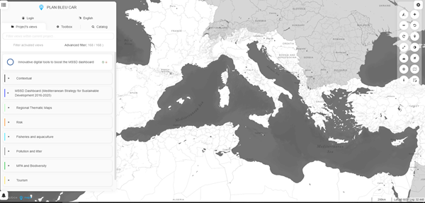
Based on the latest technologies in sharing environmental information (open source and interoperable), Plan Bleu has developed a pilot project in partnership with UNEP / GRID in Geneva to publish data it manages (from the MSSD dashboard) and make them viewable in MapX, the cartographic component of the World Environment Situation Room (WESR), the future UNEP digital infrastructure for online data sharing. This tool offers various functionalities such as the interactive viewing of environmental information and combination of maps at different scales.
With a dynamic MSSD dashboard, Plan Bleu is at the forefront to support the decision-making process and measure the progress made with regard to the sustainable development objectives linked to the environment and to multilateral environmental agreements. This goes hand in hand with enhanced governance on sharing environmental information by mobilizing the collective expertise (institutional, non-governmental, academic) of all Mediterranean stakeholders in the field of monitoring the environment.